Trusted by world's leading geospatial analysts
About

What is Frame 44

Frame 44 is a scalable web-mapping framework that enables organizations to collect, manage, and share complex geospatial and multimedia data through a single, customizable platform.

Designed with both front-end usability and back-end performance in mind, it supports crowdsourced data collection, advanced moderation, role-based user management, and enterprise-level scalability.

Whether you are a museum, research institution, NGO, or private company, Frame 44 provides the tools to transform vast, unstructured datasets into interactive maps, searchable records, and engaging digital experiences.
What is Frame 44
FETAURES

Frame 44 Features

Get in Touch
Frontend

Frontend

  • Interactive Map Interface
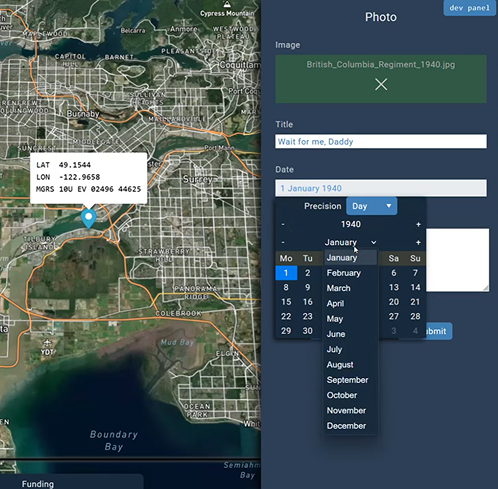
  • Data Contribution & Crowdsourcing
  • Moderation & Governance
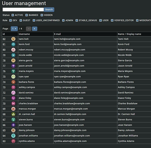
  • User Management System
  • Search & Discovery
  • Communication Tools
  • Administration Tools
  • Geospatial Data Flexibility
Backend

Backend

  • High-Performance Data Engine
  • Time-Series & Geospatial Data Support
  • User-Generated Data Contribution
  • Advanced Record Search & Spatial Queries
  • Time-Enabled Mapping
  • Open API & Extensibility
  • Separation of Frontend & Backend
Consulting

Consulting

  • Digital Mapping Strategy
  • Custom Implementations
  • Data Workflows & Integration
  • Training & Capacity Building
  • Commemorative Projects
Licensing

Licensing

  • Commercial Licensing for
  • Museums, Universities, Defence & UXO Firms
  • API Licensing for System Integration
  • Data Licensing for Curated
  • Datasets
  • Custom Licensing Packages
PARTNERS

Showcase

Project ’44
Mapping over 160,000 unit positions and 15,000 war diary pages from the Second World War.
Project Athena
A collaborative mapping platform for Afghanistan veterans to share geotagged photos and experiences.
Project Recuperation
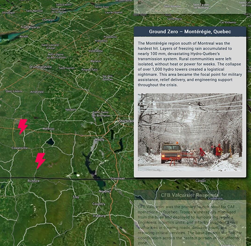
Documenting the Canadian Armed Forces’ response to the 1998 Ice Storm through interactive geospatial storytelling.
PROBLEMS

Problems Frame 44 Solves

Data Fragmentation

Instead of siloed maps, spreadsheets, and archives, Frame 44 centralizes structured and unstructured geospatial data into one accessible platform.

Scalability

Many mapping tools fail under the weight of hundreds of thousands of records. Frame 44’s backend is optimized to handle millions while remaining responsive.

Collaboration & Crowdsourcing

Traditional GIS systems are built for specialists. Frame 44 democratizes mapping by allowing anyone (with the right permissions) to contribute.
Collaboration & Crowdsourcing
Data Quality & Moderation

Data Quality & Moderation

Crowdsourced platforms often suffer from poor accuracy. Frame 44 solves this with built-in moderation workflows to review, validate, and approve data.

Engagement

Instead of static archives, organizations can publish interactive maps and story-driven content that engage broad audiences.
Engagement
Customization

Customization

Frame 44 adapts to the client’s brand and use case, rather than forcing them into rigid templates.
CONTACT

Get in Touch to Collaborate

Thank you! Your submission has been received!
Oops! Something went wrong while submitting the form.